A General Comment
There is always the temptation to put todays values and standards on historical events. areas such as poverty and the workhouse seem very harsh to us today, this was long before any welfare state, and have to be considered in that light. Local history is no different, we do have lots of facts and figures, not much in the way of records of how individual families lived, which is one objective of this group, to record the people and not just events.
It is also worth remembering that the population has doubled since the “Allotment” first appeared, in 1899 the UK was 39 million people, today in 2025 it is around 70 million.
The Allotment – The Name
Firstly, we need to be clear that “The Allotment” was not called after garden plots. It has nothing at all to do with garden allotments. The name stems from the Enclosures Act 1790 Moor Enclosure in which the Tynemouthshire Moor was broken up into allotted land parcels. A barren area on a waste moor did not merit a name of its own, hence it was tagged as the Allotment. Waste then meaning land not suitable for agriculture, used as rough grazing only.
Predominantly a mining village, farming took place at Prospect Hill Farm and Low Allotment Farm (now roughly the Village Hotel). From descriptions in various old publications the land was boggy moor and would have been very difficult to work.
The original Enclosures Act created some plots of land which had no physical links with the village or township that “owned” them, later changes moved some “allotments” around to give a more logical ownership, in the case of our village, at various stages it was allotted to Murton, Preston and later Chirton townships to create viable farms. Otherwise you would could have ended up with isolated fields or moorland far away from the “owning” village.
“Shiremoor as the same is now Allocated and let out according to an Act of Parliament made and passed in the 28th year of the reign of His Majesty George III”
| Private Act, 28 George III, c. 47 –
An Act for dividing, allotting and inclosing a certain Common Moor or Tract of Waste Land, called Tynemouth Moor, Shire Moor, Billy Moor or Billy Mill Moor, within the Manor of Tynemouth otherwise Tynemouthshire, in the County of Northumberland. -1788 |

Bells map of 1847 clearly shows that we live in the “Allotments” of the Shiremoor, again the allotment refers to the 1790 Enclosures Act, not garden allotments.
 A document which shows that the Allotment was originally allocated to the Preston Township

Houses in the Allotment Row – Image Bob Booths Collection
Shiremoor village was not established until the modern period
The Allotment is older than Shiremoor Village. The name Shiremoor refers to the common of the manor (shire) of Tynemouth, enclosed in 1790 by Act of Parliament. Early surveys recorded a pinfold and the herd’s house on the moor. By the late 18th and 19th centuries quarrying and coal mining were taking place in the locality, contributing to the development of the settlement”. (Text from Sitelines) A pinfold was an fenced area for stray cattle and a herd House was a herders home. The origin of pinfold is not known, they existed in Saxon times as they had the word “pundfald”. This gave rise to “pinfold” in the north of England and “pound” in the south, giving us the modern word “impound” meaning to enclose.
Tynemouthshire Moor at that time was described as waste land, a term used to define land that was not fit for any arable crops, at best it could be used for grazing sheep and cattle. The moor was a large boggy area, difficult to cross and without any made-up roads or paths. The name slowly changed to Shiremoor, which gave the name to the small village of Shiremoor. The Allotment was on the map before Shiremoor village.
In the late 1700’s / 1800’s the moor would have been dotted with hundreds of Bell Pits, once the coal was exhausted from one bell pit another was dug nearby. the spoil being dumped in the old hole. These bell pits were never recorded and can cause problems even today with subsidence. The shiremoor was not a place to cross at night, on your way back from an evening in one of many public houses, walking along a very rough path in total darkness, a real risk of falling into a bell pit and never seen again
The village of The Allotment, also known as Low Allotment and Allotment Farm was situated in what is now the Cobalt Hospital and the immediate area. The Northumberland Arms was built and the present vacant stone building at the rear was the brewery, the original pub burnt down. Behind the Northumberland Arms was what came to be known as Northumberland Square, two room terraced houses on the north and east sides of the Square, the name suggests something grand, when really you had some housing and a midden in the centre for all the detritus from the village. The houses had two rooms, census returns show as many as 12 residents in one house, two of them being lodgers. The loft was often used for sleeping, the children up there maybe? One of the houses also served as a Primitive Methodist Chapel, this was soon outgrown and relocated in the then unused Brewery building.
The original Allotment Village was demolished in the early 1970’s as part of a slum clearance act. No evidence remains of the original village, in the 1970’s Tynemouth Borough Council decided that the area was ideal for a domestic waste tip, when full this was capped with clay and topsoil. The entire waste tip was removed to create what we know as Cobalt, along with the waste they also removed any historical evidence of the village.

© NLS
1858 OS Map of the Allotment. © NLS
At that time The Allotment belonged to the Preston township
The land was owned by the Duke of Northumberland, who granted various leases to the Backworth Coal Company, Northumberland Estates still owns the mineral rights in the area. A thriving community grew in approximately what we know as Benton Road, the east end, from Sambucas, along the south side of the road, towards Cobalt, the terraces did not exist.
In 1898 the Backworth Coal Company took a lease on the land we know now as the terraces; the intention was to build housing for the miners they employed. Development started in 1898 with North Terrace, slowly working backwards and finishing with the “short streets”. The lease was for the land to the west of The Allotment, which included what we now know as Turner Street, the name stuck and here we are today in West Allotment. The original housing was for rent, in more recent times when the local pits were still being worked, the ownership had moved to the National Coal Board, long term residents were given the right to buy their houses.
The Allotment did have a number of “garden allotments”, these form the north section of the allotments we have today. This land was bought by the Allotments Association and is separate from the Council Allotments further to the south.
The Houses & Shops
Benton Road had a large Co-op store which is now No 41, the lease was given to two sisters who were spinsters from Whitley Bay, with a condition that they would not sell alcohol, the Backworth Coal Company also owned the lease for the Northumberland Arms, so it was not in their interest to allow competition with the pub. Early maps show they built a wooden building in front of the Coop and used this to sell alcohol, newspapers etc, it was tolerated as long as they did not sell beer and compete with the public house. (evidence needed)
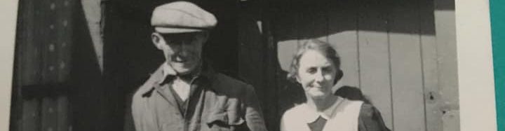
The actual West Allotment lease document was kindly given to us by Barbara Burrough, her Dad Bob Booth had started a collection of documents and photos of the Allotment. Bob had been a blacksmith employed in the local mines, then he took over running the village shop while his wife Nancy was the Sub Postmistress. This document was given to the North Shields Library Local History Collection and can be viewed by appointment. The Library is a goldmine of information and the local history team are super helpful.
The Shire Moor Allotment Map
Our area of the shiremoor was “allotted” to the Preston Township, hence the name


© NLS
Northumberland Square – © NLS
Only had two sides, but it was a common naming convention to call them Squares back then, nearby we also had Wapping and Benton Squares, all only two sided.
Todays Map
https://maps.app.goo.gl/kSurBa2rPcSooLot6
A thanks to Michael Harrison for kindly donating these 1970 aerial views of West Allotment, Backworth & the surrounding areas. PDF downloads only. We will convert them to images later. © OS

Turner Street Late 1800’s – © NLS
Turner Street did not exist until the terraces were built, before that all access was from the back lane. Were these Turners Buildings from the 1911 Census?
The back lane was also the parliamentary boundary, Tynemouth on the right and Longbenton on the left. That meant The Allotment was a village of two halves on the political and administration map. two MP’s and two Councils,
The image below is not Turner Street from around 1900, the image is typical Tyneside Terraced housing from that time. We have no images apart from a view looking down the back lane from Benton Road, very similar housing to the image. If anyone has access to any old photographs or can remember what the rear of Turner Street was like it would be great so see or hear from you.

Similar houses, image is not West Allotment
Low Allotment – A small hamlet consisting of several houses and a farmstead. Allotted to the owners of the Backworth Colliery at the enclosure of the Shiremoor, 10 chains west of the Blyth & Tyne Railway © OS Name Books

An Ordnance Surveyors notebook from the 1850’s. The OS was very diligent to ensure they used the correct names on the OS maps, surveyors checked with local people. © National Archives

The OS surveyors’ notebook transcribed. A mention of the original Northumberland Square. Information © National Archives
Prospect Hill – Info thanks to Paul Hewish (Original post on the Allotment Local History Group (Facebook)
Memories of Prospect Hill
John Walley – before xmas you asked me for my memories of Prospect Hill. I’ve attached your map, suitably annotated, with various descriptions of what I can remember about the place when visiting my grandparents in the 1950s when they lived in the cottages there.
The historically most important features were what remained of the engine winding mechanism for hauling wagons up the incline. At the top of the incline was a horizontal iron ‘jockey’ pulley on a short stout iron post (we used to stand on it as kids) which was clearly sited to direct the hauling cable at a right-angle towards the ruins of the engine winding house – annotated on the map as the “tall sandstone wall”. This walled area where my Grandfather kept chickens and what he always called the “engine house” had large stone blocks (not concrete) sunk into the ground with long, large diameter protruding threaded studs … clearly these were the mounts for the engine. Of course, all this tackle was badly bent and corroded at that time being a victim of the elements for 100+ years.
Also, in a few places down the incline were stout iron posts which must have been for other guide pulleys (long gone) but clearly for that purpose because some had ‘forked’ tops for housing the pulleys. There was a stone built tool shed on the embankment which contained massive cans of grease, sledge hammers and other railway maintenance tools used on the working railway lines … it amazed me that this shed was never locked! I can’t remember exactly which building was this store but it was one of the two annotated on the map – there were stone steps up the embankment leading to it from tracks.
The large wooden shed was built within the sandstone walled enclosure and contained a large coal-fired washing boiler and a communal toilet. This contraption was a wooden board with a hole in it and the human waste was scraped-out once a week by the Council’s ‘night soil men’.

Map © NLS – Annotation by Paul Hewish

Prospect Hill looking north from West Allotment Date ??
The footbridge / farm traffic in the distance is on the 1888 maps, long gone.

1888 map of footbridge just north of Prospect Hill. modern map for interest. © NLS
The actual “Hill” is now a railway cutting, which allowed steam locos to use the route without and help from the rope winding engine – Thanks to Paul Hewish for the original information.
Benton Road – Who Lived There?
A series of map images which show the development of Benton Road over the years.

1888

1892 – No Terraces or Turner Street yet.

1900’s
Historic Environment Record
“Throughout the past, people have left their mark on the natural environment in many different ways. Some are very obvious like the remains of Hadrian’s Wall, or the industrial workings from coal mines. Some however, are much harder to find; traces of wooden buildings, sites where food production took place or long forgotten rubbish pits. The Historic Environment Record or HER is a detailed database of above and below ground heritage assets covering the whole of Tyne and Wear. It is held by Newcastle City Council”. Quote from the HER website. https://www.twsitelines.info/
The group submitted some information on the Allotment based on our own research and after verification the Archaeology team have published it, a first for us and good to get the Allotment on the map. The PDP’s below cover the Grain Mill. Allotment Farm and the Enclosure Act of 1744 which created the area known as the Allotment, just boggy grazing land back then. A thank you to the Newcastle Council Archaeology team.
HER19176 output HER19175 output HER2176 output
The Pond – Is it natural or man made?

West Allotment Pond © Geograph
West Allotment Pond © NLS

West Allotment Pond © NLS
A land use map from the 1960’s, with a present day comparison (2024), show the area we now know as the pond was a football pitch, people have mentioned this as being a very boggy and wet bit of land.
- The Site’s Past: The area was previously a landfill (a rubbish tip).
- Development Scheme (1996): A new development project in 1996 created Silverlink Park, which included the pond and the Biodiversity Park.
- Ecological Purpose: This park was designed to restore nature, creating diverse habitats like woodland, grassland, and wetlands, with the pond being a crucial wetland feature.
- A Local Nature Reserve (2005): Recognising its importance for wildlife, the pond and park were officially designated as a Local Nature Reserve (LNR) in 2005.
- Respect the Water: Visitors must stay away from the pond edge and not enter the water due to potential hazards like deep mud, unseen underwater obstacles, and risk of disease or cold water shock.
- No Swimming/Paddling: Swimming is typically prohibited as water quality is not tested and may contain pathogens.
- Child Supervision: Children must be closely supervised by an adult at all times near water.
- Stay on Paths: To avoid damaging sensitive areas or getting stuck in mud, visitors should remain on designated paths.
- No Fishing Fishing is not allowed.
- Feeding ducks and swans, there is conflicting guidance on this, not something for a history group to debate. Bread is generally best to avoid if you can, more natural and unprocessed feeds are better for the wildlife, I tried dried cat food pellets, they seem to enjoy them?